搜索结果: 1-15 共查到“工学 Standards”相关记录89条 . 查询时间(0.093 秒)

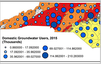
Piedmont region drinking wells exceed North Carolina's hexavalent chromium standards(图)
Piedmont region drinking wells North Carolina hexavalent chromium standards
2019/12/2
A new study that combines measurements from some 1,400 drinking water wells across North Carolina estimates that more than half the wells in the state's central region contain levels of cancer-causing...
EXPLORING SCHEMA MATCHING TO COMPARE GEOSPATIAL STANDARDS: APPLICATION TO UNDERGROUND UTILITY NETWORKS
Schema matching geospatial standard underground utility network
2018/11/9
This paper proposes a preliminary analysis of whether a schema matching approach can be applied for the comparison and possible the selection of geospatial standards. Schema matching is tested in the ...
Modeled changes in US sodium intake from reducing sodium concentrations of commercially processed and prepared foods to meet voluntary standards established in North America: NHANES
intake modeling national sodium food United States
2018/11/15
Background: Approximately 2 in 3 US adults have prehypertension or hypertension that increases their risk of cardiovascular disease. Reducing sodium intake can decrease blood pressure and prevent hype...
ABSOLUTE STANDARDS FOR CLIMATE MEASUREMENTS
Infrared Far-Infrared Radiance Climate Atmosphere Standard SI Traceable Measurement
2016/12/1
In a world of changing climate, political uncertainty, and ever-changing budgets, the benefit of measurements traceable to SI standards increases by the day. To truly resolve climate change trends on ...
ADVANCEMENTS IN OPEN GEOSPATIAL STANDARDS FOR PHOTOGRAMMETRY AND REMOTE SENSING FROM OGC
Geoprocessing Remote Sensing Open Standards OGC
2016/11/8
The necessity of open standards for effective sharing and use of remote sensing continues to receive increasing emphasis in policies of agencies and projects around the world. Coordination on the deve...
STANDARDS-BASED SERVICES FOR BIG SPATIO-TEMPORAL DATA
Big Data datacubes coverages WCS WCPS standards OGC rasdaman
2016/11/8
With the unprecedented availability of continuously updated measured and generated data there is an immense potential for getting new and timely insights – yet, the value is not fully leveraged as of ...
Current Status of International Airborne Platform Data and Instrument Interface Standards
environment facilities GIS database internet/web technology atmosphere engineering airborne science platform systems
2016/7/4
Commission I of the International Society for Photogrammetric and Remote Sensing formed working group I/1 for the purpose of standardizing airborne platform interfaces. The primary mission of this wor...
Data interchange: Helping to survive existing transfer standards
Spatial Data Access Interchange Point Data Vector Data
2016/5/20
Exchange of data between different software/hardware systems has traditionally involved porting data directly from System A to System B. With large numbers of systems, this tradition has created very ...
GUIDELINES ON BOTH SPATIAL STANDARDS FROM, AND THE MERGING OF DIGITAL TERRAIN DATA FOR EMERGENCY RISK MANAGEMENT PLANNING
LiDAR Radar Interferometry Digital Terrain Model Flood Risk Emergency Management
2016/3/17
This paper describes the development of a set of guidelines on the use and integration of digital terrain data for Emergency Risk Management (ERM) planning, specifically in relation to flood hazard. T...
USING STANDARDS AND WEB 2.0 TECHNOLOGIES FOR E-LEARNING MODULES-JOINT DEVELOPMENT OF AN EUROSDR COURSE ON CITYGML
Education Learning Teaching Web-based Standards CityGML
2015/12/22
E-learning in Europe has gained a sustainable impulse with the Bologna process, an agreement aiming at making academic degrees and quality assurance standards more comparable and compatible throughout...
COMPETENCY STANDARDS-A MEASURE OF THE QUALITY OF A WORKFORCE
Capacity Building Joint Education Photogrammetry Remote Sensing Geoinformation Management Skills Formation
2015/12/22
Competency Standards are increasingly being used by professions and governments to define the qualifications required for professionals to practise in a discipline. They define a range oflevels of com...
The GEO Standards and Interoperability Forum
Earth Observation Interoperability Standards Decision Support GEOSS
2015/12/18
The intergovernmental Group on Earth Observations (GEO) is leading a worldwide effort to build a Global Earth Observation System of Systems (GEOSS). GEOSS builds upon, and adds value to, functioning E...
Establishment of a Data Creation Methodology under the Geographic Information Standards
GIS ISO/TC211 JPGIS Standardization Product Specifications
2015/12/11
A new Japanese law requires that basic spatial data covering the entire national land of Japan are to be developed in accordance with the Japan Profile for Geographic Information Standards (JPGIS). As...
Building Croatian Spatial Data Infrastructure in Line with the European Standards
Spatial Data Infrastructure Spatial Database Interoperability
2015/12/11
Croatia is on its way to join the European Union as well as European information society what means that policies, technical standards and operational facilities should be harmonized with European sta...
ISO/OGC Standards Impact on Next Generation Enterprise Spatial Platform
Standards Interoperability Specifications Decision Support Information Development Integration
2015/12/3
The geospatial industry has finally caught up to the need for standardization required to manage the large amount of data and time consuming processes the community deals with constantly. The use of c...

