搜索结果: 1-15 共查到“国际动态 遥感信息工程”相关记录24条 . 查询时间(2.545 秒)
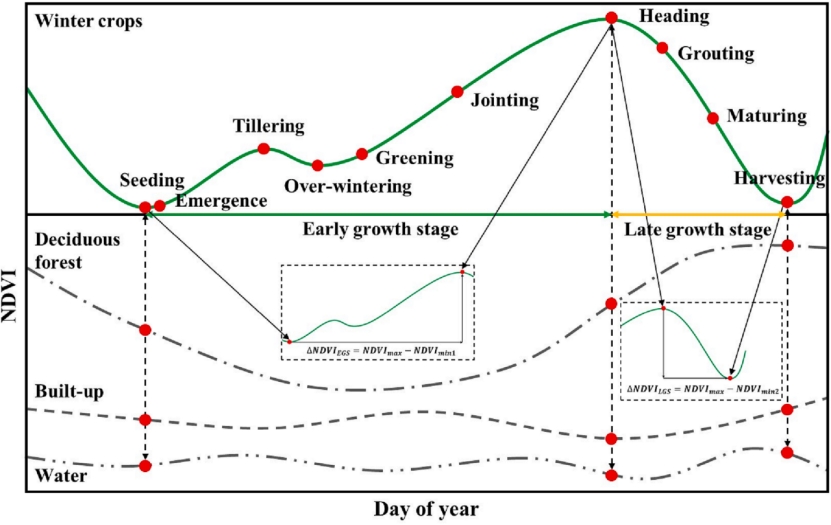
近日,农学院智慧农业创新团队在国际著名遥感期刊《ISPRS Journal of Photogrammetry and Remote Sensing》发表了题为“Automated in-season mapping of winter wheat in China with training data generation and model transfer”的研究论文,报道了他们在大尺度冬小...
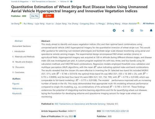
中国农业大学植物保护学院马占鸿教授团队在IEEE Transactions on Geoscience and Remote Sensing发表研究成果(图)
马占鸿 IEEE Transactions on Geoscience and Remote Sensing 小麦条锈病 遥感
2023/12/11

美国斯坦福大学近期发布第三版《全球前2%顶尖科学家榜单2021》(World’s Top 2% Scientists 2021),国家高层次人才特聘专家、芬兰科学与人文院院士、武汉大学测绘遥感信息工程国家重点实验室主任陈锐志教授同时入选全球“终身科学影响力排行榜”和“年度科学影响力排行榜”。

Researchers use satellite imaging to map groundwater use in California's Central Valley(图)
satellite imaging map groundwater California Central Valley
2020/10/16
Researchers at the University of California, San Diego report a new way to improve groundwater monitoring by using a remote sensing technology, known as InSAR (interferometric synthetic aper...
自然资源河北省卫星应用技术中心揭牌
自然资源 河北省 卫星应用技术中心 揭牌
2019/12/17
日前,自然资源河北省卫星应用技术中心揭牌成立。去年以来,河北省自然资源厅积极探索依托大学等科研院所,聚合省水文工程地质勘查院、省国土资源利用规划院、省自然资源厅信息中心、河北地质大学土地资源与城乡规划学院、河北师范大学资源与环境科学学院5个单位的科研力量,实现了卫星应用技术中心的实质性建设运行。据了解,中心的主要职能是开展国产卫星数据接收、储存、处理、分发、应用推广和技术服务工作,保障卫星数据在全...
俄方称为安哥拉发射的卫星暂时“失联”
俄罗斯能源科技生产公司 卫星 遥测信息
2018/1/2
俄罗斯能源科技生产公司2017年12月27日宣布,俄方为安哥拉发射的第一颗卫星在入轨一段时间后,“遥测信息不复存在”。目前工程专家正在努力恢复与卫星的联系。
当地时间26日晚间,俄方用一枚“天顶-2SB”运载火箭将安哥拉第一颗卫星AngoSat-1从哈萨克斯坦境内拜科努尔发射场发射升空,送入预定轨道。卫星入轨后,地面控制中心与其建立了通信联络,但一段时间后,“遥测信息不复存在”。
Portland State laser mapping project shows landscape changes in Antarctica
Portland State laser mapping project landscape changes Antarctica
2017/9/5
Portland State University researchers and the National Science Foundation (NSF) have publically released high-resolution maps of the McMurdo Dry Valleys, a globally unique Antarctic polar desert.The P...
越南未来几年计划发射4颗卫星
越南 卫星 发射升空 2018年
2017/5/19
越南科学技术院所属的国际卫星中心日前在越南航天中心2017-2022年发展计划会议上宣称,在未来几年中将开发4个卫星项目,即4至6公斤重的NANODRAGON号卫星、10公斤重的MICRODRAGON卫星、600公斤重的LOTUSSAT-1号卫星和LOTUSSAT-2号卫星。按此计划,NANODRAGON号卫星将2018年发射升空,其任务是评价水资源质量,定位水产资源,并观察沿海区域发生的各种变化...
NSF supports "Array of Things" prototype in Chicago
NSF Array of Things prototype Chicago
2016/12/13
University of Chicago scientists supported by the National Science Foundation (NSF) are collaborating with researchers at the Argonne National Laboratory to build out a wide-ranging urban se...
新型遥感仪器“闻”出火星生命迹象
新型遥感仪器 闻出 火星
2016/11/3
据美国国家航空航天局(NASA)官网2016年11月1日报道,戈达德航天飞行中心科学家基于美国军队用来监控空气中危险化学物、毒气及病原体的遥感技术,开发出一种称为“生命迹象激光探测仪”(BILI)的原型装置,利用它可以“闻”出火星和太阳系其他星球是否存在生命迹象。
Analysis exposes faster disintegration of major Greenland glacier
faster disintegration Greenland glacier
2015/12/7
A study appearing in Science magazine today shows a vast ice sheet in northeast Greenland has begun a phase of speeded-up ice loss, contributing to destabilization that will cause global sea-level ris...
Image Release: High-Def Radar Images of Near-Earth Asteroid
High-Def Radar Images Near-Earth Asteroid
2015/3/4
A team of astronomers using the National Science Foundation's Green Bank Telescope (GBT) in West Virginia and NASA's Deep Space Network radar transmitter at Goldstone, California, has made the most de...
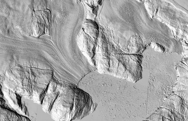
The highest-resolution satellite images ever taken of that region are making their debut. And while each individual pixel represents only one moment in time, taken together they show the ice sheet as ...


