搜索结果: 1-15 共查到“工学 mineral”相关记录58条 . 查询时间(0.07 秒)
Analytical ingredient content and variability of adult multivitamin/mineral products: national estimates for the Dietary Supplement Ingredient Database
dietary supplement reference material multivitamins sampling plan,
2018/11/13
Background: Multivitamin/mineral products (MVMs) are the dietary supplements most commonly used by US adults. During manufacturing, some ingredients are added in amounts exceeding the label claims to ...
GOLD MINERAL PROSPECTING USING PHASED ARRAY TYPE L-BAND SYNTHETIC APERTURE RADAR (PALSAR) SATELLITE REMOTE SENSING DATA,CENTRAL GOLD BELT,MALAYSIA
Gold prospecting PALSAR Bentong-Raub Suture Zone Peninsular Malaysia tropical environments
2016/11/30
The Bentong-Raub Suture Zone (BRSZ) of Peninsular Malaysia is one of the significant structural zones in Sundaland, Southeast Asia. It forms the boundary between the Gondwana-derived Sibumasu terrane ...
Object-based image analysis for the assessment of mineral extraction in conflict regions–a case study in the Democratic Republic of the Congo
land cover change natural resources mining object-based image analysis remote sensing
2016/11/24
In this study object-based image analysis (OBIA) techniques were applied to assess land cover changes related to mineral extraction in a conflict-affected area of the eastern Democratic Republic of th...
RESEARCH ON MINERAL RESOURCES PLANNING AND MANAGEMENT INFORMATION SYSTEM BASED-ON GIS TECHNOLOGY
Mineral Resources Planning and Management GIS Function Design Database Design Secondary Development
2016/3/17
Mineral resources are important non-renewable resource, its reserves are limited. However, with the social development and population growth, the depletion of mineral resources is increasing rapidly, ...
RATIO IMAGE PROCESSING TECHNIQUES:A PROSPECTING TOOL FOR MINERAL DEPOSITS,RED SEA HILLS,NE SUDAN
Landsat multispectral ratio images Red Sea Sudan
2015/12/29
The Red Sea Hills Region is a vast span of rugged, harsh and inhospitable sector of the Earth with inimical moon-like terrain, nevertheless since ancient times it is famed to be an abode of gold and w...
PREPARING MINERAL POTENTIAL MAP USING FUZZY LOGIC IN GIS ENVIRONMENT
Fuzzy Logic GIS Mapping Integration Spatial Modelling Geology Ore
2015/12/29
In vector model, the boundary between features is stored and shown categorically in an absolute way, in other words Membership or non-membership of a point in each polygon is known which can be 0 or 1...
DRILL CORE MINERAL ANALYSIS BY MEANS OF THE HYPERSPECTRAL IMAGING SPECTROMETER HySpex, XRD AND ASD IN PROXIMITY OF THE MYTINA MAAR, CZECH REPUBLIC
Remote Sensing Imaging Spectroscopy Geology Drill Cores Mineralogy Mytina maar
2016/1/15
Imaging spectroscopy is increasingly used for surface mapping. Therefore different expert systems are being utilized to identify surface cover materials. Those expert systems mainly rely on the spectr...
Integration of radarsat-1 and landsat tm images for mineral exploration in east oweinat district, south western desert, egypte
East Oweinat Principal Component Landsat TM
2015/8/21
East Oweinat district is located in the south Western Desert of Egypt. It is mainly occupied by outcrops of Archean to Early
Proterozoic rocks of high to medium metamorphic grade and younger granitoi...
The role of physical activity and diet on bone mineral indices in young men: a cross-sectional study
Dietary intake Physical activity, DXA
2015/7/28
Osteoporotic fractures are a significant cause of morbidity and mortality, particularly in developed
countries. Increasing peak bone mass in young people may be the most important primary prevention ...
Lack of a systematic idea for collecting, managing and integrating various geo-spatial data from different sources and in different
scales make mineral deposit exploration to be encountered with diff...
Mineral profile of Croatian honey and differences due to its geographical origin
honey Croatia minerals geographical origin
2015/3/30
The proportions of twelve minerals were determined in 200 samples of the black locust honey from five Croatian regions during two seasons. The average proportions were dominated by that of K (205.57–4...
DATA INTEGRATION USING WEIGHTS OF EVIDENCE MODEL: APPLICATIONS IN MAPPING MINERAL RESOURCE POTENTIALS
DATA INTEGRATION EVIDENCE MODEL MAPPING MINERAL RESOURCE POTENTIALS
2015/3/16
DATA INTEGRATION USING WEIGHTS OF EVIDENCE MODEL: APPLICATIONS IN MAPPING MINERAL RESOURCE POTENTIALS.
INTEGRATED ANALYSIS OF REMOTE SENSING, AEROMAGNETIC, GEOLOGICAL AND MINERAL OCCURRENCE DATA FOR THE ASSESSMENT OF A SUBDUCTION SETTING
Spatial data Image processing Country scale GIS Geophysics AVHRR imagery Plate tectonic
2015/2/5
The formation of Zagros Orogenic Belt of Iran, extending over 2000 km along the NW-SE direction, has been subjected
to considerable controversy. Several geologists believe that this belt has been res...
SPECTRAL UNIMIXING APPLIED TO VEGETATED ENVIRONMENTS IN THE CANADIAN ARCTIC FOR MINERAL MAPPING
Spectrum the vegetation environment map
2015/2/4
SPECTRAL UNIMIXING APPLIED TO VEGETATED ENVIRONMENTS IN THE CANADIAN ARCTIC FOR MINERAL MAPPING.

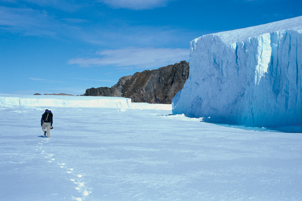
Protecting the mineral treasures of Antarctica's Larsemann Hills(图)
Protecting the mineral treasures Antarctica's Larsemann Hills
2015/3/4
It was late November 2003 and not quite summer in Antarctica. As the Squirrel helicopter lifted off after delivering its last load, we set about putting up our two tents and making camp on Stornes Pen...

